Cold Front
The schematic diagram below shows the frontal boundary in a cold front system with the cold air passing under the warmer air.
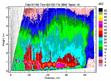
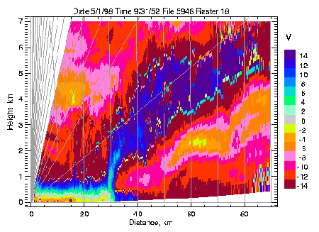
The figures below (click to enlarge) show actual measurements of the cross-polar reflectivity (dBZ) and the velocity (V) taken during the passage of a cold front covering a distance out to 90km from the radar. An animation shows the passage of this front.
Turbulence in the presence of weather fronts
Researchers have observed the nature and distribution of shearing instability and turbulence in frontal shear zones. This leads to a better understanding of the effect of mixing on the structure of frontal zones and the role of the large-scale flow and thermodynamic fields in generating turbulence. These results will be used to validate current and future developments in the mesoscale versions of the Met Office Unified Model. Turbulent billows are a candidate mechanism for chemical mixing between air masses at fronts.